RADHAKRISHNAN T
April 23, 2024 2024-04-29 16:21RADHAKRISHNAN T
Geoinformatics, Geospatial Technology Applications, Remote Sensing, Spatial Data Analytics and data modelling, Spatial Statistics, Web GIS and Mapping and Geospatial surveying.
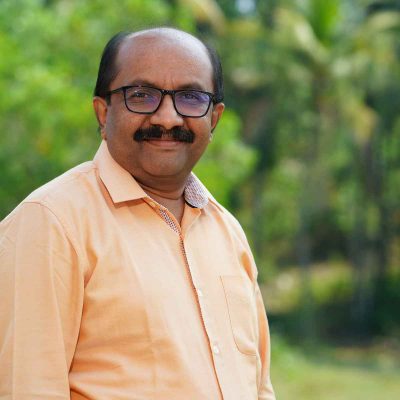
Mr.Radhakrishnan.T works in the area of Geospatial Analytics. He holds Masters in Geography and M.Tech in Remote Sensing. His key teaching/research areas include Geoinformatics, Geospatial Technology Applications, Remote Sensing, Spatial Data Analytics and data modelling, Spatial Statistics, Web GIS and Mapping and Geospatial surveying.
He had worked in Informations Verarbeitung Leverkusen (IVL) India Pvt.Ltd., and International Engineering Services prior to joining IIITMK in 2006. He is also the Course Coordinator of M.Sc Geospatial Analytics. He has served as Project Investigator in several Geospatial Technology Projects funded by various organizations (Govt.of India and Govt.of Kerala). Conducted over 40 training/capacity building programs in Geoinformatics and related areas. Guided academic projects (M.Tech, B.Tech and MCA). Spearheaded setting up of an advanced and state-of-the-art Geoinformatics Lab in the institute.
Published several papers in conferences and symposia. He is a Guest Faculty to institutions like Govt. Engineering College – Barton Hill, College of Engineering-Trivandrum, Institute of Management in Government, State Institute of Rural Technology and Development, Sree Chitra Tirunal Institute for Medical Sciences and Technology (SCTIMST), etc. He also serves as Governing Council Member Cyberdome (Kerala Police), Secretary (ISRS Thiruvananthapuram Chapter) and Treasurer(IEEE Geoscience and Remote Sensing Society, Kerala Chapter). He has served as key resource person to over a dozen workshops during the last two years.
- Implementation of A Web Accessible Geographical Information System for Mapping, Monitoring and Modeling Diseases (Department of Animal Husbandry, Government of Kerala)
- Conceptualizing, design and development of Mobile app and WebWeb GIS application for location-specific soil nutrient status mapping and fertilizer recommendation system for various cropsvarieties for Kerala, funded by Department of Soil Survey & Soil Conservation (SS&SC), Govt. of Kerala
- Assessment of Carbon Storage and Floral Diversity of Sacred Groves In Three Districts of Southern Kerala, supported by Technology Assisted Information Management – Research Project funded by Ministry of Earth Sciences, Govt. of India, jointly carried out by Indian Institute of Information Technology and Management-Kerala (IIITM-K) and Environmental Resources Research Center (ERRC).
- Integration of Soil Nutrient Information and fertilizer recommendation of North Eastern States to RubSIS Web and Mobile Application (Rubber Research Institute of India)
- Online system for evaluation and Monitoring of Water sub mission Activities for Haritha Keralam Mission (Haritha Keralam Mission, Govt. of Kerala)
- Design and Development of an Integrated and customized Course Management System and Video Conferencing System (Energy Management Center, Government of Kerala)
- Design and development of Mobile app for Census of Rubber area and Web based Dashboard for administration and management (Rubber Board, Ministry of Commerce & Industry, Government of India)
- Design and Development of an Integrated Mobile and Web based Application for Herd Book Scheme and Progeny Testing The project involves Design and develop an integrated Mobile and Web based application for Geo-tagging, monitoring and evaluation of Herd book and Progeny Testing
- Radhakrishnan T., and Manojkumar Thananthu Krishnan. ‘Citation Network Analysis of Geostatistical and Machine Learning Based Spatial Prediction’. Spatial Information Research, May 2023.
- Radhakrishnan T., Manojkumar Thananthu Krishnan, “A Novel Ensemble Method for Spatial Prediction of Soil Organic Carbon”, Journal of Data Acquisition and Processing, 2023, 38 (2): 3625-3637.
- Radhakrishnan T., Manojkumar T.K., Sudhis Kumar K.P., Lal Prakash P.L, “Geostatistical Modeling of Soil nutrients and development of a mobile application for site-specific fertilizer recommendation”, 2019 IEEE Recent Advances in Geoscience and Remote Sensing : Technologies, Standards and Applications (TENGARSS), Kochi, India, 2019, pp. 148-150, doi: 10.1109/TENGARSS48957.2019.8976057
- Kumar, R. A., Aslam, M. K., Raj, V. P., Radhakrishnan, T., Kumar, K. S., & Manojkumar, T. K. (2016). A statistical analysis of soil fertility of Thrissur district, Kerala. 2016 International Conference on Data Science and Engineering (ICDSE).
- Prithivi K., Nikhil P., Radhakrishnan T., “Plant species diversity index mapping using sentinel-2 satellite imagery in western part of Pathanamthita district”, Hinweis International Conference on Computer Science, Cyber Security and Information Technology (CCIT), April 22, 2023, Kochi.
- Sthanu, L. K., Sarasamma, J. D., Iyer, R. T., & Chellappan, M. (2013). Soil quality mapping studies using nematodes as Bioindicators. Open Journal of Soil Science, 03(07), 323-335.
- Karthika Mohan, Radhakrishnan T, Manojkumar T. K, Girish M.S,Modelling Spatial Variability of Load Carrying Capacity of Soil Using GIS, International Journal of Recent Development in Engineering and Technology (ISSN 2347 – 6435 (Online)) 2 (6), 72-76, June 2014,


